Why the Serengeti Looks the Way It Does
The Serengeti isn’t just beautiful — it’s a 14,750 km² geological masterpiece that explains why millions of wildebeest return here every year.
The Big Picture
- Elevation: 920 m (Lake Victoria) → 3,636 m (Crater Highlands)
- Age of the basement rock: up to 4 billion years (older than almost anything on Earth)
- Powered by: the East African Rift — two tectonic plates slowly tearing Africa apart
Fly in over Kilimanjaro Airport (JRO) and you’ll see the scars of this drama from the air.
Kopjes: Serengeti’s Iconic Rock Islands
- Formed when molten granite forced its way up 600 million years ago
- Softer rock eroded away → left rounded granite “islands”
- Act as fireproof refuges, water catchers, and predator perches
- Best places: Seronera, our eastern Serengeti camp, Gol Mountains
Serengeti Nexus Tip: Ask your guide to stop at Simba Kopjes at sunrise — guaranteed lions.
The East African Rift in Action
- Still-active volcano: Ol Doinyo Lengai (“Mountain of God” in Maa) — last eruption 2013
- Ngorongoro Crater: a collapsed caldera, not an explosion crater
- Volcanic ash = mineral-rich soil = short nutritious grass = 8,000 wildebeest calves born daily in Ndutu
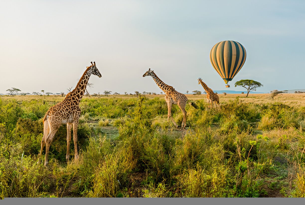
See It from the Sky
Hot-air balloon safari (~$599) gives you the ultimate geological overview — kopjes, river meanders, and volcanic plains all in one golden-hour flight.
Why Safari with Serengeti Nexus?
- Guides who actually explain the geology (not just “look, a lion”)
- Camps positioned on the best soils for year-round game
- Balloon safaris with geological briefing before take-off
“I never knew rocks could be this exciting until our guide explained why the plains turn green exactly where the wildebeest give birth.”
— David M., Australia (2025 balloon safari)
Ready to see the ancient engine behind the world’s greatest wildlife show?
Book your 2025–2026 Serengeti safari with Serengeti Nexus and discover the geology that powers the Migration.
Start Planning | View All Safari Itineraries | Contact Us
See you on the endless plains! 🌅🦁